Um Ihnen ein möglichst angenehmes Surf-Erlebnis zu bieten, werden auf dieser Seite Cookies verwendet. Mehr darüber erfahren Sie hier.

Allow cookies

The Svartfjell Trail (12 km)

Product Image
  • Product Image
  • Product Image
  • Product Image
  • Product Image
  • Product Image
  • Product Image

Über

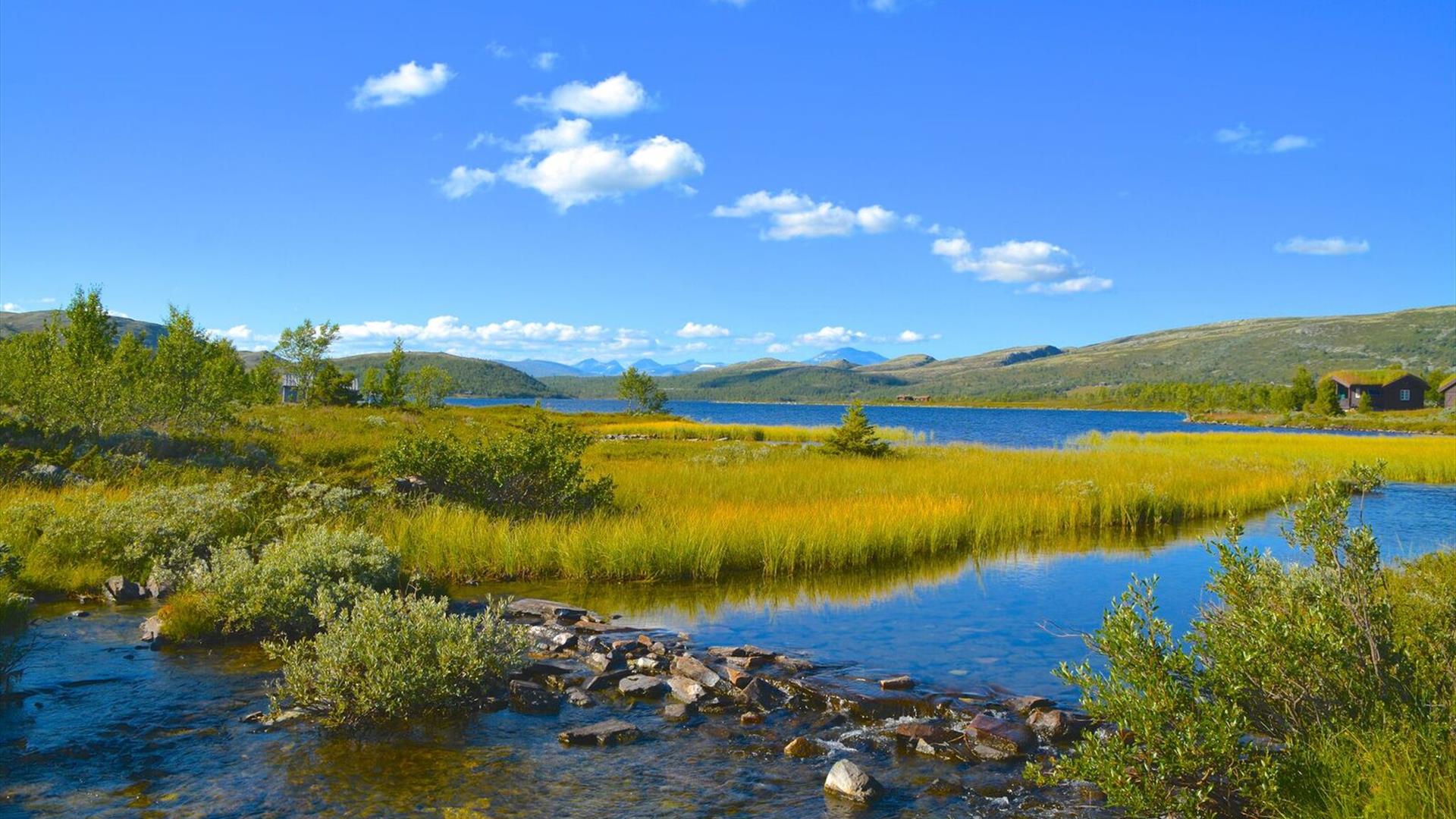
This is a longer hike that goes along both trails and graveled roads. This is a hike with beautiful nature, nice mountain trails and you might walk around the big lake “Flaksjøen”. If you take the path to the top of Svartfjell you will get rewarded with a stunning view of the Rondane massif. This is a hike that suits children from 10 years and above, but this off course differs depending on the level of experience they have with hiking. There are no difficult parts but the whole hike is quite long.

Follow the graveled road northwards from Spidsbergseter, towards the crossing where you see Flasksjøen. Take to the left and follow the road to the “end” of the lake. Take to the right and follow the road over a small bridge and further on until you are at the base of Svartfjell. From here there’s a clear trail (hold to the right) leading to the top of the mountain 1154 meters above sea level. This is our version of “Besseggen”. It’s an easy hike to the top, but it might tingle a little bit in the stomach for those not very fond of heights. The view from the top is amazing. There is a bench along the path where you are able to eat your lunch or just take a short break. Return the same way as you came, or take to the left at the base of the mountain – towards the small mountain farm. Here you will find a path going on the west side of Flaksjøen, towards Flaksjøsetrene and the last km back to Spidsbergseter along a graveled road.

Maps «sommerturer Venabygdsfjellet» and «Venabygdsfjellet» is to be bought in the reception at the hotel. There are also maps for the game “Stolpejakten” where this route is marked.

Einrichtungen

Altersgrenze

  • Erwachsene
  • Kinder

Dauer

  • 5 Stunden

Einstufung

  • Mitte

Saison

  • juni
  • juli
  • august
  • september
  • oktober

Kontaktiere uns

Tel.: 61 28 40 00

Fax: 61 28 40 01

Flaksjølivegen 82
2632 Venabygd

The Svartfjell Trail (12 km) zu Ihrer Route hinzufügen

In der Nähe

  1. The Veslefjell Round (12km)

    This tour offers a really nice view towards Muen which the highest mountain top in the…

    0 m Entfernung
  2. Viewpoint Flaksjølihøgda(1,5 km)

    This is a short walk from Spidsbergseter Resort Rondane where the whole family is able to…

    0 m Entfernung
  3. Indre Uksan (12 km)

    This is cross country skiing in the Rondane National Park and it’s not too physically…

    0 m Entfernung
  1. The boat dock at Flaksjøen

    Feeling like spending the day in a quiet way and eating your lunch outside in a…

    0 m Entfernung
  2. Dørfallet (14 km)

    Die Fahrt nach Dørfallet bietet eine wunderschöne Aussicht in Richtung Muen, und die…

    15 m Entfernung
  3. Svartfjell-Tour (15,9 km)

    Der Ausflug nach Svartfjell bietet eine spektakuläre Landschaft mit Bergen, Seen und…

    15 m Entfernung
  4. Familienausflug nach Svartfjell (10 km)

    Der Ausflug nach Svartfjell bietet eine spektakuläre Landschaft mit Bergen, Seen und…

    15 m Entfernung
  5. Langlaufski Rondane-Lillehammer (Troll-Loipe)

    Die Troll-Loipe verläuft durch den herrlichen Rondane Nationalpark im Norden und…

    453 m Entfernung
  6. Riding Holidays for Beginners | Venabu Fjellhotell

    Riding holiday in the mountains for beginners. Learn in a safe environment and have a…

    2.42 km Entfernung
  7. Venabu - Myfallet – Venabu.

    Venabu - Myfallet – Venabu. The route starts vis-à-vis the turn-off to Venabu Mountain…

    2.41 km Entfernung
  8. Cross country ski lessons | Venabu Fjellhotell

    Learn to cross country ski and enjoy the process! Whether you are new to cross country…

    2.49 km Entfernung
  9. Muen

    Muen – der höchste Gipfel in der Gemeinde Ringebu!

    6.00 km Entfernung
  10. The Trabelia Round (10km)

    This trail is groomed every day through the season and the terrain allows for good tracks…

    9.14 km Entfernung
Previous Next

Planen Sie Ihre Reise

  • Aktivitäten

  • Übernachtung

  • Veranstaltungen

  • Essen und trinken

Aktivitäten suchen

Umweltzertifizierte Anbieter
Type:
Region
Ort
Name / Passwort:

Unterkünfte suchen

Umweltzertifizierte Anbieter
Type:
Region
Ort
Name / Passwort:

Veranstaltungen suchen

Umweltzertifizierte Anbieter
Type:
Region
Ort
Name / Passwort:
Datum:

Essen und Trinken suchen

Umweltzertifizierte Anbieter
Type:
Region
Ort
Name / Passwort:

Planen Sie Ihre Reise

Aktivitäten suchen

Umweltzertifizierte Anbieter
Type:
Region
Ort
Name / Passwort:

Unterkünfte suchen

Umweltzertifizierte Anbieter
Type:
Region
Ort
Name / Passwort:

Veranstaltungen suchen

Umweltzertifizierte Anbieter
Type:
Region
Ort
Name / Passwort:
Datum:

Essen und Trinken suchen

Umweltzertifizierte Anbieter
Type:
Region
Ort
Name / Passwort: